 www.planeur.net vous propose de tres nombreux documents en libre téléchargement :
 [PARTENAIRE] TopMetSat App
TopMeteo propose une nouvelle application permettant d'accéder simplement aux dernieres images satellite .... en acces libre avec un abonnement TopMeteo ;-)
 Finally released for iOS! TopMetSat - the satellite image app from TopMeteo!
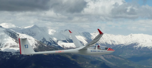
TopMetSat aims at pilots who are interested in basing their decision making for their flight path on the actual weather development. In flight information makes it possible to select a suitable routing according to the weather before running into trouble. General aviation pilots will appreciate the possibility to adjust their routing according to thunderstorms, fog, showers, and low level cloud. Using the high resolution images glider pilots, paragliders, and hanggliders can benefit from online information to adjust their course and follow convergence lines, avoid “blue areas”, or high level cloud cover. The app offers access to TopMeteo´s satellite, radar, and thunderstorm related lightning imagery.
TopMetSat has been developed by aviators and for aviators, hence the focus was on providing easy to handle and safe functionality during flight:
- to minimize distraction, the app provides a single click feature to obtain information
- in case of bad network coverage at higher altitudes the app will automatically try to download recent imagery at least a couple of times per hour
- an aircraft symbol is displayed on screen at the actual position
- already downloaded images are stored for future offline access
 Our tests have demonstrated that up to 5000ft GND new satellite imagery can be reliably received. Devices with LTE option however show the best performance and the refresh rate compared to non-LTE Devices is much higher. Please make sure to enable LTE on your iOS devices.
A very useful tool is the automatic update – the app will try to constantly keep the selected image updated. In order to use this feature on iOS devices, the display must remain switched on.
Our product Cloud Tops and Ceiling is also available in TopMetSat.
More information can be found at: http://www.topmeteo.eu/weather/gliding!topmetsat

- [SECU] Le train d’atterrissage, un sujet FH !
- [PARTENAIRE] SPOT « Flight of the Swans »
- [PARTENAIRE] Garantie Accident
- [RETRAITE] Jean LEMAIRE
- [FLARM] Installation antenne
- [LIVRE] 70 ans Buno
- [BEA] Rapport Accident
- [DGAC] Commissions de Discipline
- [2017] Université du Transport Aérien 2017
- [BUNO] 50 ans de Buno le 17 juin 2017
- [METEO] Phénomènes météo : les orages !
- [COUPE] Coupe Antoine de Saint-Exupéry 2.0
- [VIDEO] Super Salto - Glider Aerobatic Display
- [2017] Open Belgian Gliding Nationals 2017
- [REPARATION] Cable Dyneema
- [2017] Calendrier 2017
- [BUNO] T-shirts Collector pour les "50 ans de Buno"
- [EGU] European Gliding Union Congress 2017
- [BIA] Les inscriptions sont ouvertes
- [CONF] Conférence « Photos aériennes et artistiques »
- [PARTENAIRE] SPOT satellite messenger
- [SONDAGE] Sondage sur l'Information Aéronautique
- [BEA] Rapport Accident
- [NETCOUPE] Saison 2017
- [ANDROID] Théorique planeur
Page 938 sur 2282